Description
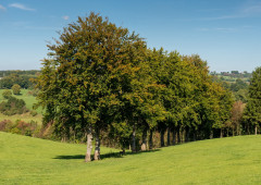
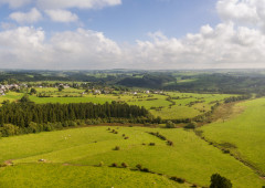
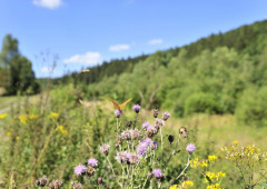
Pure nature on a hike through a vast landscape of meadows and woods.
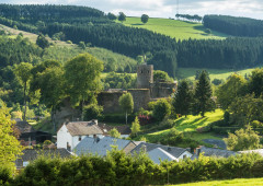
In Heppenbach, the hay harvest is beginning. The perfume of freshly mown grass is in the air. This also seems to inspire a fox who, not far off the trail, waits to ambush field mice dizzied by the midsummer air. Nature reveals itself, simply and overwhelmingly, right in front of our eyes. Sparrows whirr in the cloudless summer sky.
A beautiful trail takes us to the Möderscheid mill, where a little stream babbles contentedly through the meadows. In the narrow part of the valley at Möderscheid the farms nestle up against the slopes, embedded in the landscape. Long fences describe a landscape which puts us in mind of parts of Scotland. Once we've arrived in Hepscheid, the view we get confirms once again how good life probably is on the banks of the Amel. Further down, the natural course of the little river draws a graceful pattern through the meadows.
Hiking in the junction node network:
Follow these numbers: 25 > 14 > 15 > 2 > 80 > 5 > 25
More information: https://www.ostbelgien.eu/en/walking/hiking-route-planer
Advice
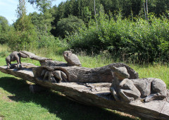
Nature and art adventure path Heppenbach.
Details
-
Difficulty Medium
-
Physical condition
-
Experience
-
Landscape
-
Highest point
582 m
-
Lowest point
460 m
-
Best period for this activity
January
-
February
-
March
-
April
-
May
-
June
-
July
-
August
-
September
-
October
-
November
-
December
Safety instructions
A hike with a medium gradient. Strong ascent to Möderscheid. Dogs must be kept on a leash.
Recommended equipment
Light hiking or jogging shoes are sufficient for this route on passable roads and paths.
Information and additional links
East Belgium Tourist Agency npo
Hauptstraße 54
4780 Sankt Vith
+32 80 22 76 64
info@ostbelgien.eu
www.ostbelgien.eu
BE 0715 454 578 - RJP/RPM Eupen
Contact details
Departure
Start at the church and follow the road leading up to the left. GPS coordinates: 50.2183 - 6.1308
Arrival
Near the catholic church in Heppenbach.
Itinerary
Hiking in the junction node network:
Follow these numbers: 25 > 14 > 15 > 2 > 80 > 5 > 25
More information: https://www.ostbelgien.eu/en/walking/hiking-route-planer
Author's recommendations
The most beautiful hikes – Pleasure tours – www.ostbelgien.eu - Tourist Shop - Free brochures
Map recommended by the author
St.Vither Land & oberes Ameltal – Hiking map / IGN - 1:25.000 / www.ostbelgien.eu - Webshop
Difficulty level
-
Difficulty Medium
-
Distance
14.7 km
- Duration
3.59 h.
- Positive altitude difference
256 m
- Positive altitude difference
256 m
Circular walks
To do with/as family
Geological interest
Interest - The flora
Interest - The animal world
Dog Friendly
Difficulty level
- CountryBelgium
- RegionRégion Wallonne
- ProvinceVerviers
- DepartmentBüllingen