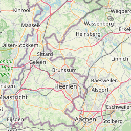


Kelmis
Formerly Neutral-Moresnet, now Kelmis. For more than a hundred years, from 1816 to 1919, Neutral-Moresnet constituted an oddity of European history.


Kelmis – a place with a curious history
The name of the village of Kelmis is derived from the zinc ore calamine, which was known as kelme in the region. It was mined there from the early Middle Ages until the end of the 19th century. The village became known internationally in the period from 1816 to 1919. The genesis of the neutral condominium of Moresnet goes back to a conflict between the United Kingdom of the Netherlands and Prussia in determining new borders following the demise of the French Empire. A local coin was minted under the name 'Free Community of Moresnet', but it never went into circulation in the neutral zone. In 1886, eight postage stamps were issued too, with the idea of founding an autonomous local postal service. But they were only on sale for a fortnight, as the postal service was a state monopoly.
Numerous historical relics enable visitors to immerse themselves in the enigmatic past of Kelmis. That history is explained in a clear and interesting way on the history trail, the industrial educational trail, in the Altenberg conservation area, and on information boards not far from the historical zinc mines.
Point of interest

Kelmis panorama board
The panorama board is situated between points 46 and 99 in the junction node network. Because of its elevated position, it gives a particularly beautiful view on the village Kelmis. An aerial photograph of Kelmis and the surrounding area makes it possible to associate prominent places in the landscape with the curious history of Kelmis. Many walks start at the Casino pond and thus take you right past the panorama board.

Vieille-Montagne Museum
The destiny of the village of Kelmis is inseparably associated with zinc ore, which was mined there for centuries. The mining of the ore and the production of zinc were strongly influenced by the Vieille-Montagne mining company. The museum is in the company's former directorate, built in 1910. Right next door to that was the station at the end of the 1.9-km-long railway line 39 A from Moresnet to Neutral-Moresnet. Today, the entrance to the museum is in the former station building. The exhibition documents the history of mining in Kelmis and the unique political and social life in Neutral-Moresnet. In the interactive museum on two floors, visitors can travel back into the enigmatic past of the village of Kelmis with the aid of audio guides.

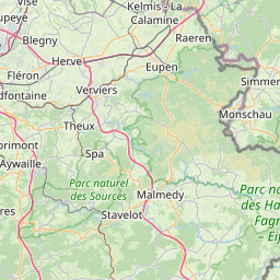
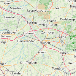
Border country
At the border triangle, the borders of Belgium, Germany and the Netherlands meet. In the times of Neutral-Moresnet, indeed, it wasn't three borders that met here, but four. At the same time, at 323 metres above sea level, the point where these borders meet is the highest elevation on the mainland of the Low Countries. The Baudouin Tower marks it on the Belgian side. There, a glass elevator takes visitors up to 50 metres. The panoramic view from the lofty platform on the tower enables them to look far out into all three countries. The border triangle is the starting point for many walks. The visitors' centre, built to accommodate the needs of the disabled, has a restaurant, and there is a large playground for the little ones. A hedge labyrinth offers entertainment and pleasure for the whole family.

History trail
The Kelmis history trail runs through the middle of this former mining village and depicts it through the ages. The angles at which the 15 illustration plates are viewed have each been selected in such a way as to correspond to the point where the observer stands today.

Industrial educational trail
The industrial educational trail at Kelmis is a varied walk, 7.5 kilometres in length. It begins at the Park Hotel in the middle of the village and runs past various locations which were important for calamine mining in Kelmis. Numerous columns along the wayside provide background information about the industrial past of this mining village. And there is a question to be answered at each station of the educational trail. That way, visitors can test their knowledge and learn more at the same time.

Casino pond and Altenberg conservation area
The casino pond and the calamine tip at Altenberg are relics of the ore mining activities that took place around Kelmis in the 19th century. Today, the area is a popular destination for excursions and a conservation area. The ore-bearing soils from the mines around Kelmis were first washed with water from the Göhl. But since the stream did not actually have enough water in it all the time, the casino pond was created as a reservoir by means of a dam on the Tülje stream in 1862. The 'casino', which was available to the managerial staff of Vieille-Montagne for their leisure activities and gave the reservoir its name, was on its shore. At the foot of the building, there was a jetty with a bathhouse, still visible today. The mining tip, over which a footpath runs today, has been widened over the years with soil separated from the ore by washing. Over time, some specialised plants have settled in these soils, which contain a relatively high proportion of heavy metals: calamine violet (Viola calaminaria), calamine penny-cress (Thlaspi calaminare), a species of Armeria (A. halleri), a species of Festuca (F. aquisgranensis), and a species of sandwort (Minuartia verna). They make up the zinc flora (calamine meadows) or 'society of zinc-loving plants'. It may be assumed that in the dim and distant past, these plants, now protected, gave people a clue as to where ore-bearing soils might be found.

Church of the Assumption
The Catholic parish church of Kelmis is dedicated to the Assumption of Mary into Heaven. This church, built in the neo-Gothic style, was officially opened in 1865. Since then, the red brick building has hardly changed at all on the outside. The erection of the Church of the Assumption was made possible by financial aid from the Vieille-Montagne mining company and the Belgian and Prussian governments. The choir stalls in the church date from the year 1869. The former main altar, the central panel of which today serves as a tabernacle, was erected in 1867. The bells date from 1870. The way of the cross was set out in 1879. On the right-hand side of the church, in the porch of the main portal, there is a memorial plaque which is probably unique in the way it was designed: it lists the sons of the village who were killed on both fronts in the First World War (1914-1918).

St. John's Protestant Church
The foundation stone of St. John's Church was laid on 7 July 1856. The Vieille-Montagne company, at which some 120 Protestant white and blue-collar workers were employed, provided the land and a large donation. The rest came from various other collections. The interior was kept simple, as for Christians of the Protestant Church the focus is on the preaching (from the pulpit), and no paintings or coloured glass windows should distract the attention of the congregation. In 1858, a graveyard was consecrated behind the church: the tombs of the medical counsellor Dr. Molly (1838-1919), an important personality in Neutral-Moresnet, and Max Braun, senior engineer and director of Vieille-Montagne in Moresnet (died 1874) can still be seen there. In 1860, the vicarage was completed. Since 2006, the church has been listed as a historical monument.

Pennings houses
The Pennings houses are on the Lütticher Strasse not far from the entrance to the casino pond. These two rough stone houses got their name from the smith who once lived here, Willem Anton Pennings. They are among the oldest preserved houses in Kelmis. The corner house in rough sandstone was built in 1776 by Pennings and his wife Anne Barbe Groenenschild. The house can be recognised quite easily by its window surrounds hewn in limestone. There is a dated arch brick on the left-hand side in the facade as a lintel and it bears the inscription 'A.0 1776/I.W.A.P./A.B.G.' (Willem Anton Pennings-Anne Barbe Groenenschild, smith at the Altenberg Company). On the facade there is a depiction of Christ on the cross in a shell-shaped niche. The second house in the ensemble was built in rough limestone in the 19th century and is presumed to have been a stable originally.

Boundary stones
In the Preuswald, between Kelmis and Aachen, there are many different boundary stones to be discovered. They bear witness to the variegated history of this region. The Preuswald got its name from the Central German word preus, meaning 'border'. Along the hiking trails, there are still many traces to be seen of the disputes relating to territories and their borders. • Eagle stones These date from the 14th century. They demarcate the former Aachener Reich. The barrier known as the Aachener Landgraben was created in the Aachener Stadtwald (municipal forest) as a second line of protection. Some 20 of the 138 original boundary stones can still be found. They are adorned with an eagle (coat of arms of the town of Aachen). • Burgundy stones 1615 border to the Spanish / Austrian Netherlands In the Middle Ages, and well on into the modern age, the forests, with their stocks of firewood and sustenance (fruit and berries) have provided humans with valuable resources – and the way they have been exploited has duly been intensive. To the south-west of Aachen, the forestry rights were in dispute for a long time, with Aachen, Limburg (Moresnet) and the Duchy of Jülich-Berg all making claims. In 1611, the imperial town of Aachen and the Spanish Netherlands in Brussels concluded an agreement covering the forest areas that had, until then, remained in common use. To put an end to the argument, the area in question was placed under the direct care of the Dukes of Burgundy, and the so-called Königswald came into being. As from 1615, the Königswald was marked out with special boundary stones, known as Burgundy stones. These stones did not demarcate between countries or municipalities, but between common and royal forest. The 700 morgen of forest (approx. 230 hectares or 570 acres) is still known as the Königswald today. Insignia and inscriptions on the Burgundy stones, of which there were various different versions, were always made so as to face the Königswald. If the stones depict a Golden Fleece, they date from the period of Spanish rule (17th century). If they bear the bough cross of Burgundy, they were erected during the period of Austrian rule (18th century). Some of them can still be seen in the forest today. • Boundary stones of Neutral-Moresnet In 1869-1870, the wooden border posts of the neutral condominium of Moresnet were replaced with boundary stones. The borders were drawn in the form of a straight line through houses, meadows, woods etc. Not even the customs officers knew exactly where they were. More than 50 of the 60 boundary stones can still be found today. • Present-day boundary stones The present-day boundary stones are marked with a D on the German side and a B on the Belgian side. The line on the top shows the direction in which the border runs. Every five years, these boundary stones are checked by German and Belgian survey officers and adjusted or repainted if necessary.

St. Rochus Chapel
The St. Rochus Chapel was first mentioned in official documents in 1646. It is located at the confluence of the Hohn and Grünstrasser streams on the southern edge of what is Kelmis today. The chapel and the surrounding farmsteads formed the original nucleus of this mining village. However, an altar stone discovered during restoration work on the chapel provided clues that the chapel may have been erected even earlier. The stone was subsequently embedded in the north wall of the chancel. The chapel is dedicated to St. Rochus, who was revered as a patron saint who provided protection against the plague. Rochus, in respect of whom there is no verified historical source material, has never actually been canonised by the Catholic Church, but he was among the most popular of all saints for centuries. As the patron saint of plague victims, he was highly revered by the people during the time of the great mediaeval plague epidemics. In 2004, the chapel was completely restored, both inside and out.

Eyneburg
The Eyneburg was built on a hill high up above the Göhl. It is one of the few hilltop castles in the former Duchy of Limburg. The name Eyneburg or Eyneberghe comes from a family to whom this manor house belonged in the 13th century. The name 'Emmaburg', used for the complex in the vernacular, goes back to a legend according to which a daughter of Charlemagne, Emma, lived there for a time. However, this association, not tenable in historical terms, was not made until the 19th century. Today the Eyneburg is privately owned. Its valuable interior was auctioned off in 1958.

Calvary of Moresnet
The place of pilgrimage that is Moresnet-Chapelle is a place of veneration of the Virgin Mary and consists of a chapel of mercy, the pilgrimage church and the park-like Calvary with its way of the cross. It has its origin in the miraculous healing of the Moresnet citizen Arnold Franck from his falling sickness in about 1750. In 1875, Franciscan friars from Aachen settled in Moresnet and took over the organisation of the cult of the Virgin Mary which was beginning in the region. During this process, they built a way of the cross for the faithful on the Calvary. For each of the stations on the way of the cross, a concave vault was built with bricks of the kind used in circular kilns. The decorative material for the stations was supplied by local factories and donated by craftsmen. The area framing the way of the cross was planted with 68,000 ornamental plants, some of them exotic, and they still make up a colourful park today. The Calvary was finally completed in 1903. Since then, it has been the destination of numerous processions.

Moresnet: Göhl valley viaduct
With an overall length of 1107 metres and a height of 52 metres, the Göhl valley viaduct spans the Göhl valley near Moresnet. For some time, it was the longest bridge in the Belgian rail network. The viaduct is part of the connection between the German Ruhr and the port in Antwerp. During the German occupation of Belgium in the First World War, it was built by order of the German military authorities. Approximately 14,000 labourers and prisoners of war were deployed in its construction. Many of them failed to survive the strenuous, hazardous work. The shell was completed in the unimaginably short time of seven months. In the Second World War, the viaduct was destroyed by Belgian soldiers in 1940 in an attempt to make it more difficult for German troops to advance. It was repaired when German occupation began again, but destroyed anew in 1944 by German soldiers, this time to make it more difficult for the allied troops to advance. Towards the end of the 20th century, about 70% of the goods traffic between the port in Antwerp and Germany was using this viaduct. Today, some 80-100 goods trains per day go over it, mostly at night.
Contact us
High Fens House for Tourism – East Belgium NPO
East Belgium
Place Albert I 29a
4960 Malmedy
T. +32 80 33 02 50
E. info@ostbelgien.eu
S. www.ostbelgien.eu