Description
In East Belgium there are still a few places which unfold their magic subtly and can be discovered on foot.
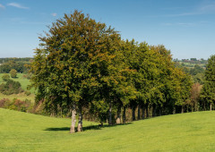
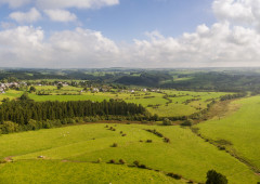
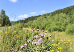
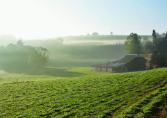
In Manderfeld your view extends uninterruptedly all the way to the horizon. Little villages have settled in the valleys, and they are connected by grey country roads that go up and down the hills. This hiking trail, which runs from Merlscheid steeply downhill to the farms at Afst, features villages, hamlets, chapels and ways of the cross. The Schmidtsbach, the whitewashed farm buildings, the other-worldly landscape: it's rare to see such a harmonious picture of man and nature.
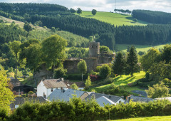
Because of its very remoteness, indeed, Krewinkel became the hub of a smuggler's trade which went to and fro over several ridges between Belgium and Germany. In Weckerath the descent to the headstream of the Our begins. On the opposite bank, Manderfeld stands proud on the hill.
Hiking in the honeycomb network:
Follow these numbers: 7 > 2 > 26 > 5 > 72 > 10 > 73 > 31 > 4 > 11 > 9 > 13 > 23 > 8 > 21 > 7
More information: http://go.ostbelgien.eu/routenplaner-wandern
Advice
The Ardennes Culture Boulevard is at the edge of this route.
Details
-
Difficulty Medium
-
Physical condition
-
Experience
-
Landscape
-
Highest point
600 m
-
Lowest point
480 m
-
Best period for this activity
January
-
February
-
March
-
April
-
May
-
June
-
July
-
August
-
September
-
October
-
November
-
December
Safety instructions
A hike over well accessible roads and paths. Dogs must be kept on a leash.
Recommended equipment
Hiking boots recommanded. Refreshments in Hergersberg (Krippana), Weckerath or in Manderfeld.
Information and additional links
East Belgium Tourist Agency npo
Hauptstraße 54
4780 Sankt Vith
+32 80 22 76 64
info@ostbelgien.eu
www.ostbelgien.eu
BE 0715 454 578 - RJP/RPM Eupen
Contact details
Departure
In front of the Café-Restaurant Hotel des Ardennes. GPS coordinates: 50.1982 - 6.2045
Itinerary
Hiking in the honeycomb network:
Follow these numbers: 7 > 2 > 26 > 5 > 72 > 10 > 73 > 31 > 4 > 11 > 9 > 13 > 23 > 8 > 21 > 7
More information: http://go.ostbelgien.eu/routenplaner-wandern
Difficulty level
-
Difficulty Medium
-
Distance
15.1 km
- Duration
4.0 h.
- Positive altitude difference
275 m
- Positive altitude difference
276 m
Circular walks
Viewpoint(s)
Catering points
Practical advice
Dog Friendly
Difficulty level
- CountryBelgium
- RegionRégion Wallonne
- ProvinceVerviers
- DepartmentBüllingen