

Sankt Vith
A town marked by history


Holiday destination with a high recreational factor
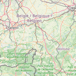
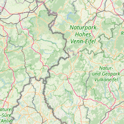
The urban community of Sankt Vith is at the crossover between the Eifel and the Ardennes. Thanks to its excellent position in terms of transport connections, its green surroundings and its many leisure amenities, this holiday destination has a high recreational factor to offer. Gourmets too are familiar with Sankt Vith, as they can enjoy both local and international cuisine in its high-class restaurants.
Point of interest

Panorama board Sankt Vith
This panorama board is 500 m from the 'Vennbahn' cycle route and between points 45 and 97 in the junction node network (Walleroder Weg). An aerial photograph of the town provides perfect orientation. The town centre, with its cafés, restaurants and shopping amenities being only a stone's throw away and well worth a stop.

Sankt Vith – a town marked by history
Sankt Vith is thought to have developed into a market town and a place of pilgrimage in about 900 A.D. Two trade connections were essential to this development: the Roman road from Reims to Cologne and the connection of the abbey towns of Malmedy and Prüm intersected on the Sankt Vith plateau. The town was first mentioned in official documents in the 12th century, along with its customs post, St. Vitus' Church and the market. In about 1350, the Luxembourg feudal lord Johann von Valkenburg fortified the flourishing market town with a castle, a town wall and some defensive towers. In spite of that, the town was destroyed on several occasions during the Middle Ages as a result of military conflicts and devastating fires. The Treaty of Aachen in 1748 brought a degree of calm. Sankt Vith was now under the rule of the Austrian heiress to the throne, Maria Theresia. During her time in office, the Sankt Vith tanning tradition was founded. Sankt Vith leather had an excellent reputation and was delivered by horse cart as far as Leipzig and Frankfurt. The Invasion by French troops (1795) marked the beginning of Sankt Vith's time in the Département de l'Ourthe, which was to end in 1815 with the reorganisation of Europe at the Congress of Vienna. From then on, Sankt Vith belonged to the Prussian Rhine Province. After the First World War, the districts of Malmedy and Eupen were allotted to the Kingdom of Belgium. When German troops invaded in May 1940, the area was assimilated by the Third Reich. However, there were no actual acts of war until the German Ardennes Offensive in 1944. At first, German troops occupied the town shortly before Christmas, but over Christmas itself, the allies reduced Sankt Vith to rubble with bombing raids. During these hostile activities, 90% of all the buildings in the town were destroyed. Reconstruction was to take until the 1960s. Nowadays, Sankt Vith is a lively cultural and business centre with 10,000 inhabitants. The region is particularly appreciated by gourmets, hikers and cyclists.

History museum 'Between Venn and Schneifel'
The former station building at Sankt Vith dates from the Prussian period and is home to the history museum today. The history of the region is documented here in multimedial and interactive theme rooms, from the Celts all the way through to the 20th century. In addition, visitors can view exhibitions on interesting topics such as the history of the Vennbahn, regional church history and skilled crafts and trades.

Vennbahn cycle route
The Vennbahn, a leisurely cycling route on a former railway line, connects Aachen with Luxembourg (125 km) and runs right through the middle of the village . The maximum average gradient is two per cent. Info: www.vennbahn.eu

Büchelturm
The Büchelturm, which dates from the 14th century, was part of the fortifications which were destroyed in the 17th century, originally consisting of a town wall with six defensive towers. Today, the Büchelturm is the landmark of the town. Built on a hill (büchel = hill), the tower stood on the edge of the town and was visible from afar until 1945. After the Second World War, the area around the Büchelturm was heaped up with the rubble from the ruined town. From the tower platform, you can enjoy a panoramic view of Sankt Vith and the surrounding areas. The key is available from the Tourist Information in the town hall.

Historical tour – Sankt Vith before 1945
In the 19th century, the townscape of Sankt Vith was still dominated by slate-clad half-timbered buildings. These were largely destroyed in 1944 in an allied air raid. The historical tour 'Sankt Vith before 1945' provides a vivid insight into the historical townscape at 14 locations. Numerous black-and-white photos with explanations in four languages document the charm of the town prior to its destruction. The perspectives of the picture panels are chosen in such a way that they correspond approximately to the viewer's current position.

St. Vitus' Parish Church
As early as 1130, a church building was mentioned in Sankt Vith. Over the centuries, it was damaged, extended and converted on several occasions. During the bombardment of the town in August and December 1944, this place of worship was so severely damaged that it had to be rebuilt. St. Vitus' Parish Church was officially opened in 1959 after a construction period of five years. The neo-Romanesque architecture was complemented with contemporary objets d'art by the sculptor Zygmunt Dobrzycki. They form an exciting contrast to some of the mediaeval and baroque objects from the buildings that preceded them. For example, the font, the tombstone of Herr von Rolshausen and the statue of St. Vitus from the ruined church were all integrated in the new building. In its design, the church features rich symbolism, which identifies it as a church of the resurrection. That is emphasised by an oversized sculpture of the risen Christ in the choir. The steeple, which stands on a broad base and tapers upward, symbolises our yearning toward Heaven. An enormous geometrical drawing on a blue background on the ceiling of the choir symbolises the micro and macrocosm. The spiral that runs right through it is the expression of a theological message: God is at the beginning. He created everything. He is infinite and eternal. The seven niches in the apse symbolise the seven sacraments. The alternation of large and small arches in the aisles refers to the ups and downs of life and the path that leads to God. The three main entrances make reference to the Trinity or the three divine virtues: faith, hope and love. The entrances, relatively small when compared with the mighty steeple, suggest humility and a stooping posture when entering the place of worship. Reliefs of the four evangelists adorn the arch supports. People who are plagued by stress or nervous diseases undertake pilgrimages to St. Vitus, patron of the town and the church, above all during the annual St. Vitus Octave in June.

Town park – 'Millionenberg'
After the Battle of the Bulge at Christmas 1944, the town was completely destroyed and demolished. All the rubble and all the belongings of the population were gathered together to form a hill, which symbolically bears the name Millionenberg. On this site, there is now a park and a nature trail with interesting facts about regional rocks and plants.

Town hall square
The newly designed town hall square of Sankt Vith invites passers-by to take a seat in a semicircle around the St. Vitus column. The sculpture by the artist Ralf Ehmann, which weighs three and a half tonnes, stands in a fountain that symbolises the five former communities. Chiselled around it in stone are the names of the 28 villages that make up the municipality.

Triangel
With the opening of the 'Triangel' in September 2009, the town of Sankt Vith received a new status as a cultural, conference and exhibition centre. Every year, on the former station grounds at Sankt Vith, some 50,000 people from Belgium and the German-Luxembourg border region make their way to the very varied events at the 'Triangel'.
Contact us
High Fens House for Tourism – East Belgium NPO
East Belgium
Place Albert I 29a
4960 Malmedy
T. +32 80 33 02 50
E. info@ostbelgien.eu
S. www.ostbelgien.eu