Responsible for this content East Belgium Tourist Agency
Verified partner
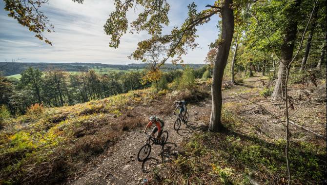
Mountainbike Hertogenwald Eupen
Photo: Dennis Stratmann, CC BY-SA, East Belgium Tourist Agency
Hint
Explanation
Selected alternatives for you
Mountain bike ride through the Hertogenwald forest and along Lake Eupen that requires advanced fitness and riding skills.
moderate
Distance 35.3 km
Duration4:00 h
Ascent520 m
Descent520 m
Highest point434 m
Lowest point262 m
The loop starts at the Wetzlarbad in the south of Eupen. Shortly after the Black Bridge the first path along the Hill is already waiting for you. Via a mix of gravel paths and partly technical climbs you quickly reach the bank of the Weser dam. After some spicy climbs and challenging descents, you ride again along the banks. A long descent via Schönefeld takes you back to the Weser and to the Schorberg. Here, you will find flowing and technical trails that are remarkably close to the city of Eupen. There are even hills, ramps, and drops. Be careful if you are unsure. The hardest parts can always be avoided. In the lower town of Eupen you can enjoy the nature again and you are almost back at the starting point. At the end, you reach the Bike Park of Eupen. Both experienced and novice bikers will have a lot of fun on the slopes and jumps. Please note that riding in the Bike Park is at your own risk. Make sure you have the necessary equipment!
Author’s recommendation
In the lower town of Eupen and next to the Weser dam several cafés and an ice cream parlour invite you to enjoy a short break.
Author
Tourismusagentur Ostbelgien
Update: November 27, 2024
Difficulty
S2moderate
Overall difficulty
moderate
Derived from the technical difficulty and the stamina requirements.