


Explanation
Through broadleaf and coniferous woods to a lake
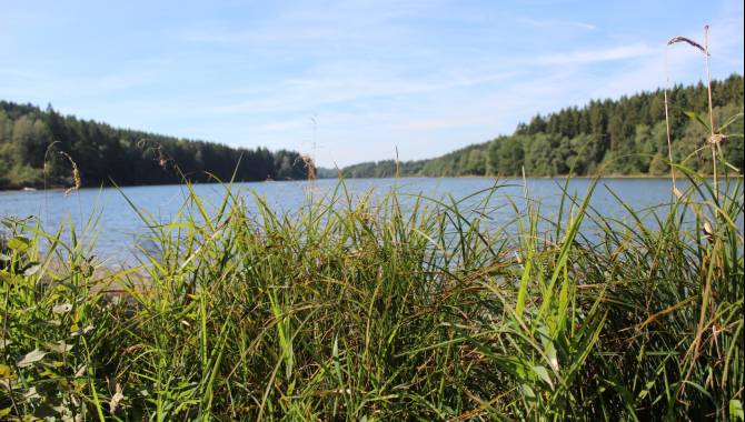
For most of this walk, you’re passing through broadleaf and coniferous forest. It starts with a climb, but once at the top you follow a wide forest path. This soon narrows into a path wondrously straddled by tree roots. The more sporty among you might like to try doing the exercises on the fitness trail. Others can continue at a more leisurely pace until they finally reach open countryside – the perfect moment to pause and let your eyes take in the view over Bütgenbach Lake.
This artificial lake was created in 1932, when a 23-metre-high dam was built across the River Warche. It’s busy in summer, when watersports enthusiasts and sun worshippers flock to the shores from far and wide. You can also go sailing or kayaking on the lake, and anglers are also welcome. The numerous small bays invite you to linger – but note that barbecuing is prohibited!
More information under: www.ostbelgien.eu/en/walking/walking-with-kids
The brochure is only available in German, French and Dutch.

Derived from the technical difficulty and the stamina requirements.
Somewhat suited for prams
East Belgium Tourist Agency
Hauptstraße 54
4780 St. Vith
Tel. +32 80 22 76 64
Make sure to wear hiking shoes and clothes according to the weather.
Derived from the technical difficulty and the stamina requirements.