Responsible for this content East Belgium Tourist Agency
Verified partner
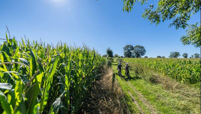
MTB Tour 3 - Lontzen
Photo: Dennis Stratmann, CC BY-SA, East Belgium Tourist Agency
Hint
Explanation
Selected alternatives for you
Mountain bike ride through hollow ways and meadows between Lontzen, Hauset and Walhorn that requires advanced riding skills.
moderate
Distance 28.7 km
Duration2:35 h
Ascent275 m
Descent275 m
Highest point312 m
Lowest point198 m
The loop starts at the castle not far from the church in Lontzen. The first single trail can be reached via a beautiful hollow way that leads trough the village to Busch. The slopes that you will find here can easily be avoided if you are unsure. Enjoy the beauty of nature through gravel paths and short trail-like passages. Shortly afterwards, you will pass two quarries on a gravel path that offers beautiful views. The last meadow path leads you right back to the castle of Lontzen.
Author’s recommendation
The flower village Hergenrath invites you to take a rest on the terrace.
Author
Tourismusagentur Ostbelgien
Update: June 26, 2024
Difficulty
S1moderate
Overall difficulty
moderate
Derived from the technical difficulty and the stamina requirements.