Responsible for this content East Belgium Tourist Agency
Verified partner
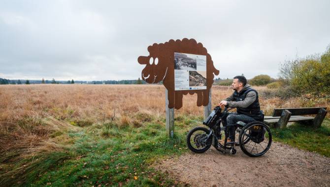
Sentier de la Trientale
Photo: Chris_Eyre-Walker_ostbelgien.eu, CC BY-SA, East Belgium Tourist Agency
Hint
Explanation
Selected alternatives for you
This walk is located in the High Fens. On the way you will discover the English helix and a magnificent viewpoint.
easy
Distance 1.4 km
Duration0:20 h
Ascent1 m
Descent1 m
Highest point562 m
Lowest point558 m
The accessible route is around 750 metres long. At the end, you can turn around and return to the parking, or be picked up by car at the end of the trail.
Author’s recommendation
As part of the ‘Natur'accessible’ project, each of Wallonia's nature parks has chosen a trail in a Natura 2000 area that can be used by people with disabilities.