


Explanation
A walk for nature explorers of all ages
Learn to recognize animal tracks and identify the sounds of the forest: it’s something the whole family can do on the nature adventure trail in Heppenbach. It’s where art, nature and learning come together. At the beginning of the walk, coniferous and mixed woodlands alternate. The path then goes a little uphill to a place called the "Hepscheider Kneppche". If you need a little rest, there is a bench waiting for you here. You then pass the Rugtloof quarry, with its impressive rockfaces.
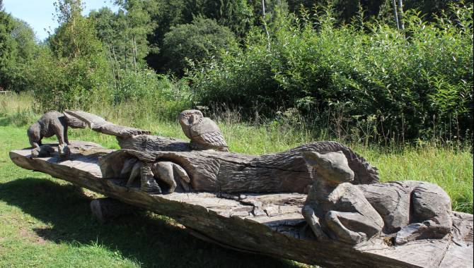
You enter the nature adventure trail via an overgrown path that leads you into a beautiful broadleaf forest. True to its motto "With all your senses", you can feel, smell, see and hear as you participate, test and marvel. The adventure trail appeals to the explorer in everyone. Play a tune on the tree organ or take a seat in the forest theatre. On small paths off the main path, you will find other imaginative installations. Some are mysterious, like the glass house, where stories of children from all over the world have been assembled. Others are impressively large, like the “twelve-pointer”. Now, what kind of animal is that? Come here to find out!
More information under: www.ostbelgien.eu/en/walking/walking-with-kids
The brochure is only available in German, French and Dutch.

Derived from the technical difficulty and the stamina requirements.
Somewhat suited for prams
East Belgium Tourist Agency
Hauptstraße 54
4780 St. Vith
Tel. +32 80 22 76 64
Make sure to wear hiking shoes and clothes according to the weather.
Derived from the technical difficulty and the stamina requirements.